
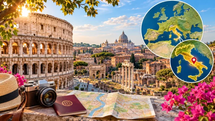
Rome is located in central Italy, in the Lazio region of southern Europe. It is the capital of Italy and one of the world’s most historically important cities. Famous for ancient ruins, remarkable architecture, and cultural landmarks, Rome attracts travelers interested in history, art, and Italian traditions. Its location also makes it a convenient starting point for exploring other destinations across Italy.
If you are wondering where is Rome on the map, the city lies along the Tiber River, approximately 25 kilometers from the Tyrrhenian Sea. It is home to famous attractions such as the Colosseum, Roman Forum, and Trevi Fountain. This guide explains Rome’s geographical location, surrounding areas, transportation connections, climate, and essential travel facts.
Where Is Rome Located in the World?
Rome is located in Europe, specifically in the central-western part of Italy. The city serves as the country’s national capital and an important center for government, culture, and tourism. Italy extends into the Mediterranean Sea as a peninsula shaped like a boot. Rome lies along the western side of this peninsula, making it relatively accessible from several Italian regions.
On a world map, Rome appears in southern Europe, between the western Mediterranean and the eastern parts of the continent. The city is located south of major European destinations such as Paris and Berlin. Its geographical position has historically connected it with different Mediterranean societies. Today, Rome remains an important destination for international travel and cultural exchange.
Rome is also one of Europe’s most recognizable historical cities because of its connection with the ancient Roman Empire. Although modern Rome is a busy metropolitan area, its historic center preserves landmarks from different centuries. Visitors can explore ancient ruins alongside Renaissance buildings and modern neighborhoods. This combination makes its geographical and cultural identity particularly interesting.
Where Is Rome on the Map of Italy?
Looking at a map of Italy, Rome sits in the central part of the country, slightly toward the western coast. The city belongs to Lazio, a region that stretches from inland hills toward the Tyrrhenian Sea. Florence lies to the north, while Naples is located farther south. These neighboring destinations help travelers understand Rome’s position within the Italian peninsula.
Rome is situated approximately 230 kilometers southeast of Florence and around 190 kilometers northwest of Naples by straight-line distance. Road and railway journeys are longer because transportation routes do not follow perfectly straight paths. The city is well connected with other major Italian destinations. This makes it a practical stop during a journey through several regions.
A detailed Rome city map reveals the Tiber River, historic neighborhoods, major roads, and public transportation routes. Many of the most famous attractions are concentrated around the historical center. Vatican City appears toward the western side of central Rome, while the Colosseum lies farther southeast. Understanding these locations makes planning sightseeing routes easier.
Which Region of Italy Is Rome In?
Rome is the capital of the Lazio region, an area of central Italy known for its historic towns and varied landscapes. Lazio includes coastal areas, mountains, lakes, and agricultural countryside. The region also contains important archaeological sites connected with ancient Roman civilization. Its geographical diversity allows travelers to explore different environments without traveling across the entire country.
Lazio consists of several provinces and administrative areas, with Rome serving as its main political and economic center. Beyond the capital, destinations such as Tivoli, Viterbo, and the Castelli Romani offer additional cultural attractions. These places feature historic buildings, traditional communities, and attractive landscapes. Visitors can experience a different side of central Italy through regional excursions.
The Lazio region also plays an important role in Italian food traditions. Popular local dishes include pasta alla carbonara, cacio e pepe, and other familiar Roman specialties. Seasonal ingredients and regional cooking methods influence restaurant menus throughout the area. Exploring Lazio helps visitors understand that Rome’s cultural identity extends beyond its famous monuments and archaeological attractions.
What Are Rome’s Latitude and Longitude?
Rome’s geographical coordinates are approximately 41.9 degrees north latitude and 12.5 degrees east longitude. These coordinates identify its position on Earth and help digital mapping systems locate the city accurately. Latitude measures distance north or south of the Equator, while longitude measures position east or west of the Prime Meridian. Together, they provide a precise geographical reference.
The city’s northern latitude places it within the temperate zone of the Northern Hemisphere. This helps explain why Rome experiences distinct seasons rather than consistently tropical conditions. Its eastern longitude also determines its position within European time zones. Rome follows Central European Time during winter and Central European Summer Time when daylight saving time is observed.
Travelers can enter Rome’s coordinates into a digital map to explore its surrounding geography. The city appears inland from the western Italian coastline, with the Tiber River passing through its urban area. Nearby hills and countryside shape the wider landscape. These geographical features influenced Roman settlement patterns and continue to affect the city’s modern layout.
Is Rome Near the Mediterranean Sea?
Rome is relatively close to the Mediterranean Sea, although its historic center is not directly on the coastline. The nearest coast lies along the Tyrrhenian Sea, which forms part of the wider Mediterranean basin. Coastal communities such as Ostia and Fiumicino are located west of central Rome. This gives visitors opportunities to combine sightseeing with a trip to the seaside.
Ostia is a popular coastal district within the municipality of Rome, offering beaches, restaurants, and opportunities for seaside relaxation. The nearby archaeological site of Ostia Antica preserves the remains of an important ancient Roman port settlement. Visitors can explore old streets, buildings, and public spaces there. This combination makes the area interesting for history enthusiasts and coastal travelers.
The distance between central Rome and the coast varies depending on the destination and chosen route. Travel usually involves regional rail services, road transport, or a combination of connections. Summer visitors often explore the coastline when temperatures rise in the city. However, beach conditions, facilities, and transportation schedules should be checked before planning a day trip.
Where Is Vatican City Located in Rome?
Vatican City is located within the urban area of Rome, on the western side of the Tiber River. Although surrounded by Italy, it is an independent sovereign state rather than an ordinary Roman neighborhood. It is internationally recognized as the headquarters of the Roman Catholic Church. Its unique political and religious status makes it an important geographical landmark.
The Vatican is home to St. Peter’s Basilica, St. Peter’s Square, and the Vatican Museums. These landmarks attract visitors interested in religious history, art, and architecture. The Sistine Chapel is particularly famous for its Renaissance artwork. While the Vatican is geographically surrounded by Rome, visitors should remember that it has its own administration and visitor arrangements.
Reaching the Vatican from central Rome is usually straightforward through public transportation or walking routes. The nearby Prati and Borgo neighborhoods provide access to restaurants, shops, and other attractions. Visitors should check admission requirements and dress expectations for religious sites. Planning ahead is useful because major Vatican attractions can attract substantial crowds throughout the year.
Why Was Rome Built in This Location?
Rome’s original location offered important geographical advantages to its early inhabitants. The settlement developed near the Tiber River, which provided access to water, transportation, and surrounding agricultural areas. Nearby hills offered defensible positions and places suitable for settlement. These features helped Rome develop from an early community into an increasingly influential city.
The traditional Seven Hills of Rome are an important part of the city’s historical identity. They include the Palatine, Capitoline, Aventine, Caelian, Esquiline, Quirinal, and Viminal hills. Ancient settlements developed across these elevations before becoming part of a larger urban center. The hills continue to influence Rome’s geography and the location of several archaeological landmarks.
Rome’s position also supported trade between inland communities and Mediterranean coastal settlements. Access to the Tiber helped connect different economic and cultural networks. Over centuries, the city expanded through political organization, military power, and infrastructure development. Geography contributed to its early growth, although Rome’s rise depended on many historical factors beyond location alone.
Famous Landmarks and Neighborhoods in Rome
The Colosseum is among Rome’s most famous attractions and stands near the Roman Forum in the city’s archaeological center. Built during the Roman Empire, it remains an important symbol of ancient engineering and public entertainment. Nearby, the Palatine Hill provides additional historical sites. Visitors can explore several important landmarks within a relatively concentrated area.
The Pantheon, Trevi Fountain, and Spanish Steps are other recognizable destinations in central Rome. Their architecture and surrounding streets attract visitors throughout the year. Piazza Navona offers another beautiful public space featuring historic buildings and fountains. Walking between these attractions allows travelers to appreciate how different periods of Roman history coexist within the modern city.
Rome also has distinctive neighborhoods worth exploring beyond the major monuments. Trastevere is known for its narrow streets, restaurants, and lively evening atmosphere. Monti offers independent shops and attractive streets near ancient landmarks. Prati features broad avenues and convenient access to Vatican City. Each neighborhood offers a different perspective on everyday life in the Italian capital.
How to Get to Rome From Other Countries
Rome is accessible from many international destinations through its major airports. Leonardo da Vinci–Fiumicino Airport is the city’s principal international airport and handles flights from numerous countries. Rome Ciampino Airport also serves travelers, particularly on certain European and regional routes. Available services vary by airline, season, and departure location.
Fiumicino Airport is located southwest of central Rome near the coast. Travelers can reach the city using trains, buses, taxis, and other authorized transportation services. The Leonardo Express connects the airport with Roma Termini railway station. Ciampino Airport has different ground transportation connections, including bus services and combinations of buses and trains.
Rome can also be reached by rail from several European cities, although international trips may require connections. Travelers visiting multiple Italian destinations often use the country’s high-speed railway network. Before booking, compare travel times, luggage arrangements, and arrival locations. Choosing transportation based on your itinerary can make the first day of your trip more comfortable.
How to Travel Around Rome Easily
Rome has an extensive public transportation network that includes metro trains, buses, trams, and urban rail services. The metro is useful for traveling between several major districts and popular attractions. However, not every historic landmark has a station directly beside it. Walking often remains necessary, particularly within older neighborhoods where streets are narrow.
Roma Termini is one of the city’s main transportation hubs, connecting railway services with metro lines and local public transportation. Roma Tiburtina is another important railway station for regional and longer-distance journeys. Visitors can use route-planning tools to compare connections. Checking current schedules is helpful because construction, service changes, and public events may affect travel arrangements.
Walking is an enjoyable way to explore Rome’s historical center because many attractions are relatively close together. However, cobblestone streets, uneven surfaces, and busy pedestrian areas can make some routes slower than expected. Comfortable footwear and realistic daily plans help make sightseeing easier. Travelers with mobility needs should investigate accessible transport options and attraction facilities before visiting.
What Is the Weather Like in Rome?
Rome has a Mediterranean climate characterized by generally hot, dry summers and mild, wetter winters. July and August are usually among the hottest months, with daytime temperatures sometimes becoming uncomfortable for extended outdoor sightseeing. Summer also brings long daylight hours. Visitors should prepare for strong sunshine and plan regular breaks during particularly warm weather.
Spring and autumn are often appealing seasons for exploring Rome on foot. Temperatures are generally more moderate, making it easier to visit historic landmarks and public squares. However, rainfall remains possible, especially during parts of autumn. Seasonal weather can vary from year to year, so checking the forecast before departure is always sensible.
Winter in Rome is usually milder than in many northern European destinations. Days can still feel chilly, particularly during rainy or windy conditions. Snow is uncommon in the city center, although colder weather occasionally occurs. Winter travel may appeal to visitors who prefer fewer crowds at some attractions, while seasonal holidays can still create busy periods.
Best Places to Visit Near Rome
Rome’s central location makes it an excellent base for exploring surrounding destinations through short excursions. Tivoli is a popular option, known for its historic villas and landscaped gardens. Visitors can discover impressive architecture and archaeological attractions beyond the capital. Its relative proximity to Rome makes it suitable for travelers who want a cultural day trip.
The Castelli Romani area offers scenic towns, lakes, and traditional regional food experiences southeast of Rome. Frascati and Castel Gandolfo are among the better-known destinations in this area. Travelers can enjoy historic streets and countryside views while experiencing a quieter atmosphere. These towns provide an interesting contrast to Rome’s busy sightseeing districts.
Visitors with additional time can consider destinations farther away, including Florence, Naples, and Orvieto. Rail connections make several Italian cities accessible for day trips or overnight stays. However, travel time should be balanced against the amount of sightseeing planned. Spending more time in fewer locations often creates a more relaxed and rewarding journey.
Conclusion
Rome is located in central-western Italy, within the Lazio region, along the Tiber River and relatively close to the Tyrrhenian Sea. Its geographical coordinates are approximately 41.9 degrees north and 12.5 degrees east. The city serves as Italy’s capital and surrounds the independent state of Vatican City. This location has shaped Rome’s history, culture, and transportation connections.
The city’s famous landmarks, historic neighborhoods, and Mediterranean climate make it an attractive destination for travelers from around the world. From the Colosseum and Roman Forum to Trastevere and the Vatican, Rome offers a remarkable variety of experiences. Its public transportation network and railway connections also make exploring other Italian destinations relatively convenient.
Understanding where Rome is located helps travelers plan transportation, choose accommodation, and organize sightseeing routes more effectively. Whether you are visiting for ancient history, architecture, food, or culture, the city offers memorable experiences throughout the year. A little geographical knowledge makes navigating Rome easier and helps you appreciate its important place in European history.
FAQs
Where is Rome located in Italy?
Rome is located in central-western Italy, within the Lazio region. It lies along the Tiber River, approximately 25 kilometers from the Tyrrhenian Sea, and serves as the national capital.
Is Rome in northern or southern Italy?
Rome is in central Italy, not northern or southern Italy. It is located in the Lazio region, between Florence to the north and Naples to the south.
What country is Rome in?
Rome is in Italy, a country in southern Europe. It is Italy’s capital and one of the country’s most important political, historical, cultural, and tourism centers.
Is Vatican City part of Rome?
Vatican City is an independent sovereign state surrounded by Rome. Although geographically located within the city’s urban area, it is politically separate from Italy and has its own administration.
How far is Rome from the sea?
Central Rome is approximately 25 kilometers from the nearest Tyrrhenian coastline in a straight line. Actual travel distances vary, with coastal destinations such as Ostia reachable by public transportation or road.

